Book your transfer
Passenger reviews
2024-11-18
Budapest Airport (BUD), Ferihegy, Liszt Ferenc-Tököl
Punctuality: 5 Driver: 5 Vehicle: 5
2024-07-26
Budapest Airport (BUD), Ferihegy, Liszt Ferenc-Nagymaros
Great service!
Punctuality: 5 Driver: 5 Vehicle: 5
2023-12-25
Brussels city (all areas)-Brussels Zaventem Airport (BRU)
Punctuality: 5 Driver: 5 Vehicle: 5
2023-08-18
Brussels Zaventem Airport (BRU)-Tienen
Satisfied with the service.
Punctuality: 5 Driver: 5 Vehicle: 5
2023-05-06
Rotselaar-Brussels Zaventem Airport (BRU)
Alles verliep perfect: stipt, een goede en vriendelijke chauffeur en een comfortabele wagen.
Punctuality: 5 Driver: 5 Vehicle: 5
2023-04-17
Wavre-Charleroi Airport Brussels South (CRL)
Just perfect
Punctuality: 5 Driver: 5 Vehicle: 5
2022-11-28
Vienna Airport (VIE)-Brno
Punctuality: 5 Driver: 5 Vehicle: 5
2022-11-14
Prague Airport (PRG)-Prague city (all areas)
Very punctual: the driver was waiting for me at the airport and picked me up on time for the return.
Driver: Both drivers were very efficient and friendly.
Vehicle: in both cases the vehicles were in excellent condition.
I'll be very happy to use the service again.
Punctuality: 5 Driver: 5 Vehicle: 5
2022-10-26
Mauritius Airport (MRU)-Sugar Beach Hotel
Perfect! The driver was waiting for us at Time! He was very welcoming and nice!
Punctuality: 5 Driver: 5 Vehicle: 5
2022-08-20
Mauritius Airport (MRU)-Le Meridien Hotel
Excellent in all… highly recommended!
Punctuality: 5 Driver: 5 Vehicle: 5
Transfer from Brussels Airport to Aaigem
Low cost airport taxi transfers to/from Aaigem are available at transfers2airports.com either from Brussels Airport or Charleroi Airport.
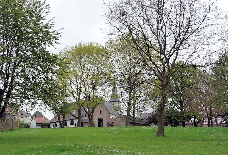
The historic village of Aaigem is in East Flanders province. The settlement belongs to the municipality of Erpe-Mere, with some 2000 inhabitants. This picturesque village was an independent municipality with an area of 7.32 square kilometers till 1976.

Low cost airport taxi transfers to/from Aaigem are available at transfers2airports.com either from Brussels Airport or Charleroi Airport.
The distance from Aaigem to Charleroi Airport is 92 kms and to Brussels Airport is 50 kms.
Minibuses and coaches are available for groups. For special requests and tailor-made transfers please contact us.
Aaigem is north of the hilly Flemish Ardennes, and is also a part of the Denderstreek. The village is situated on the northern end of Molenbeek-Ter Erpenbeek brook’s valley. The creek passes through Aaigem, south of the centre. Most part of the valley is a wet land, therefore there are limited possibilities to develop any construction.
The area is a lowland area. The height interval is some 50 meters within the settlement. The centre of Aaigem is about 53 meters above sea level, with the Molenbeek brook being about 30 meters above sea level. The elevation of the highest point in Aaigem is 77.8 meters above sea level. It is also the highest point of the whole municipality of Erpe-Mere. The lowest point is at 27 meters height, at the bottom of the Gotegemberg Hill.
There is a 205 hectare nature reserve area called Den Dotter in the sub-municipalities of Aaigem (municipality Erpe-Mere) and Heldergem (municipality Haaltert).
Name
From etymological point of view, Flemish toponyms ending with -gem refer to a Germanic compound of -haim, meaning ‘home’ or ‘residence’, and a derivative ending -inga. The first part of the word „Aaigem” is generally assigned to the Germanic name of Ago, who is unknown at the present moment. The whole compound Agingahaim meant ‘residence of the followers or tribal members of Ago’. Place-names ending with ‘gem’ are typical for the period of Frankish settlement through the Merovingian era, notwithstanding the fact that nothing is known about Aaigem’s history at that time. The earliest records about the village go back to the 11th century.
History
The territory of Aaigem belonged most likely to the Abbey of Saint Peter or the Abbey of Saint Bavo in Ghent before the Viking conquest. From the beginning of the 12th century the church of the village belonged to the diocese of the Anchin Abbey (in Pecquencourt, near Douai in northern France). This abbey held much of the land in Aaigem till the French Revolution. The main source of livelihood was agriculture throughout the 20th century. However, some industrial activity, water mills, for instance, have taken place. The few rural industrial activities of the 19th and 20th century, such as dairying, have not survived.
In the feudal age the Aaigem was a region of the Land of Aalst, and within this area, it was part of the Land of Haaltert, later also called Land of Rotselaar, after the name of the Lords of Rotselaar, who remained liege of this fief through generations.
Only a few villages in Flanders has preserved the Frankish village green (Dutch: dries), and Aaigem is one of them. It is about 1 kilometer east from the present village centre.
There are three water mills preserved in the village. All of them are on the Molenbeek Brook, with the names as follows: the Engelsmolen, the Ratmolen and the Zwingelmolen. The oldest records of the Engelsmolen and the Ratmolen go back to the 16th century, but the current buildings were erected in the 19th century. In 1870, a steam engine was installed in the Engelsmolen, but all its activity was ceased in 1956. The Zwingelmolen has been reconstructed as a dwelling house.
Most of the Saint-Nicolas Church (in full: Saint-Nicolas- and Saint-Leonard Church) was built in 1786, in a place of a smaller Gothic church, of which only the tower from ca. 1300 has remained. This was the crossing tower of the former church. Traces of the roof, of the side aisles and choir are still visible on the tower. The 18th century construction is neoclassical, planned by the architect F. Drieghe, who was also architect for the construction of the Saint-Christopher Church in Evergem.
